This story is part of SyriaInFocus, a series on Syrian photography funded by the Friedrich Naumann Foundation for Freedom, with guest editor Sima Diab. Read this article in Arabic here.
I began by launching the drone, a crude model equipped with an external camera that lacked both high definition and accuracy.
The first attempt was difficult, and the drone fell, but I managed to get it back without losing it. I could not afford repairing or replacing it, as it was my most precious possession. I was gripped by that idea, but it wasn’t long before I spotted something that was more valuable than my feelings and selfish greed. I saw the destroyed buildings, standing in a line. Merely describing them does not do them justice, at least not as much as a passer-by could, simply seeing them with the naked eye. I gained good experience from my ventures, and I flew my drone whenever the wind was calm, and missiles and aircrafts were not hovering. It was difficult to fly in cloudy or rainy weather or when the wind was strong.
Standing out in the open also put me at risk of being hit by a missile. During the battles to lift the siege on Aleppo, the city was covered with a cloud of smoke from the burning tires, an attempt to block the view on the city and mislead the regime and Russian war planes.
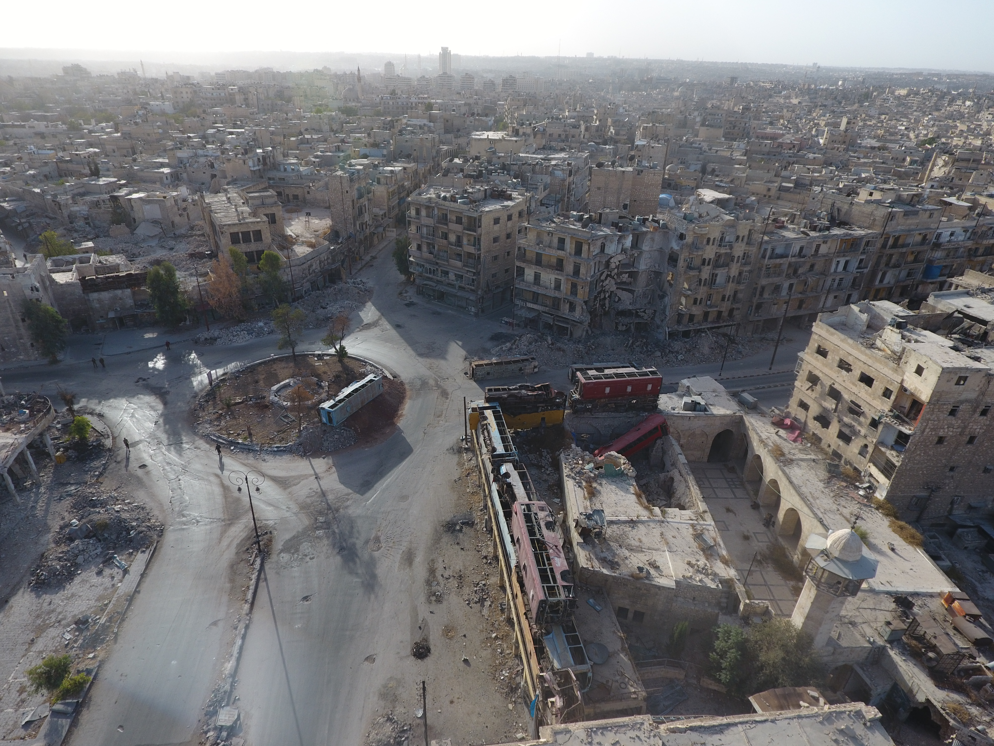
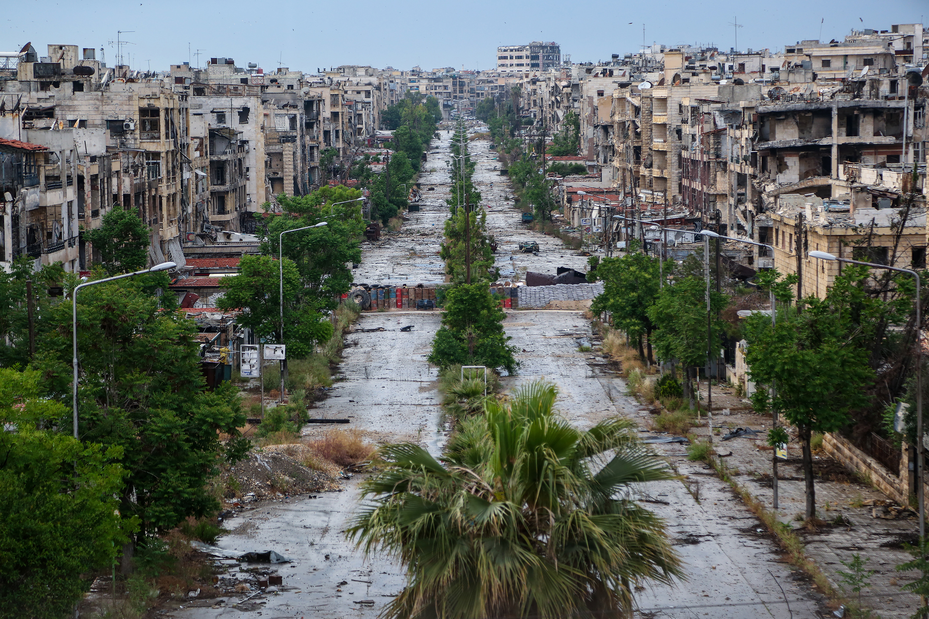
There are different angles to look at every landscape. Our view from the ground is completely different from our view from the sky. This is the Bab al-Hadid roundabout. On the left in the photo, there is the Citadel of Aleppo, and Aqyoul Street is on the right. The roundabout was exposed to snipers in the citadel, and they targeted passing cars and people until residents reinforced the buildings with buses that had been burnt by the heavy shelling on the city.
The structures served to block the view of the snipers in the citadel, so that residents could move around safely in the streets. It was common to use cloth to block the snipers’ view, but oftentimes, snipers deliberately burnt the cloth.
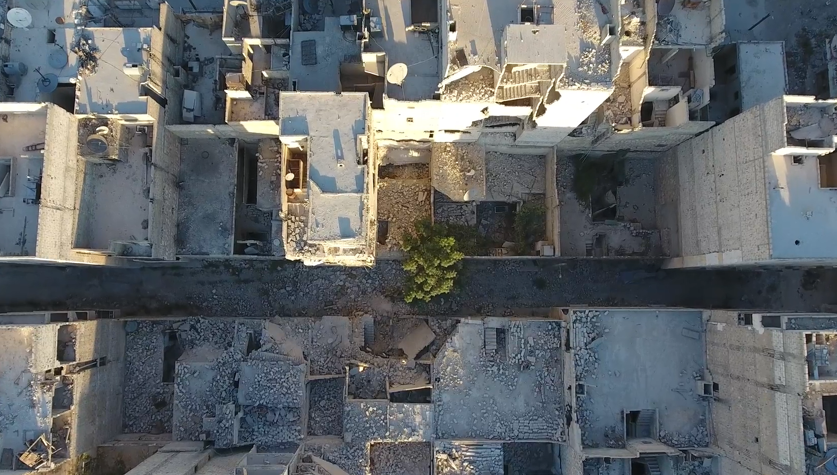
Al-Maysar neighborhood in east Aleppo, adjacent to Aleppo International Airport and Neireb Military Airport, was the target of the regime’s tanks and aircrafts a thousand times since the liberation of the city. It was transformed into a deserted neighborhood.
Some areas were given an occasional rest from attacks, and their residents returned eventually. But al-Maysar was never given a break. I would visit it from time to time and peer at the devastation.
In 2016, I decided to document the situation using a drone, during the first siege on Aleppo. The scene was horrendous. The extent of the damage was indescribable and hard to assess from both the ground and the sky. The neighborhood lost most of its landmarks and remained a mere testament to the brutality that had occurred. Rubble remained in most streets.
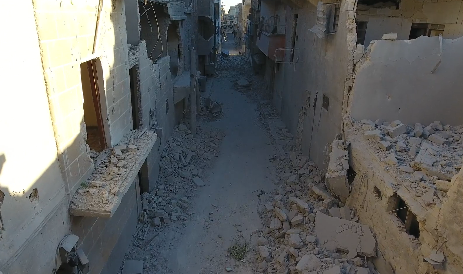
These old neighborhoods are valuable. Our origins and heritage are rooted there. And yet they were not spared the shelling of tanks and aircrafts.
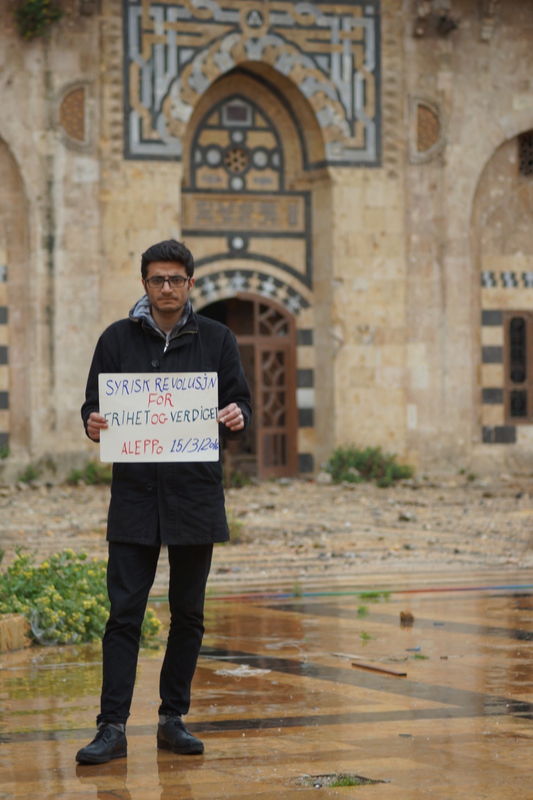
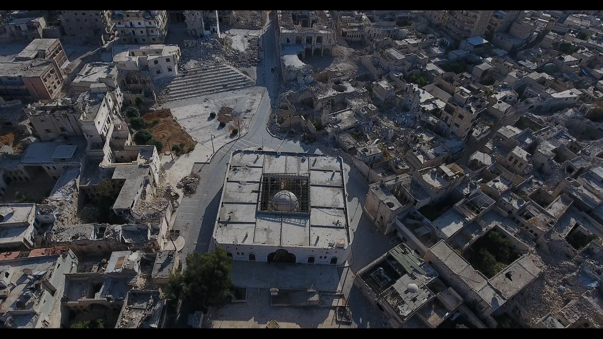
The regime turned Aleppo’s citadel into a military barracks, from which it destroyed the neighborhoods of the old city. The houses became unlivable, exposed to the onslaught. Traditional Arab homes in particular were less safe than higher buildings. Many streets were also exposed to the citadel’s snipers. During my visit, I only saw some families standing their ground. In the photo appears the historic al-Maydani Mosque with its Mamluk-era character. Most of its structure was destroyed due to the shelling.
The neighborhoods resisted until the end of 2016. More than 300,000 people who had remained during the months of the big siege were forced by the regime to leave their neighborhoods, either to regime-controlled areas or to the unknown.
Everybody tried to stand their ground, but the brutality we witnessed was stronger than our ability to stay.